Dosya:Yugoslavia map norwegian.svg

Tam çözünürlük (SVG dosyası, sözde 595 × 431 piksel, dosya boyutu: 315 KB)
Bu dosya Wikimedia Commons'ta bulunmaktadır. Dosyanın açıklaması aşağıda gösterilmiştir. Commons, serbest/özgür telifli medya dosyalarının bulundurulduğu depodur. Siz de yardım edebilirsiniz. |
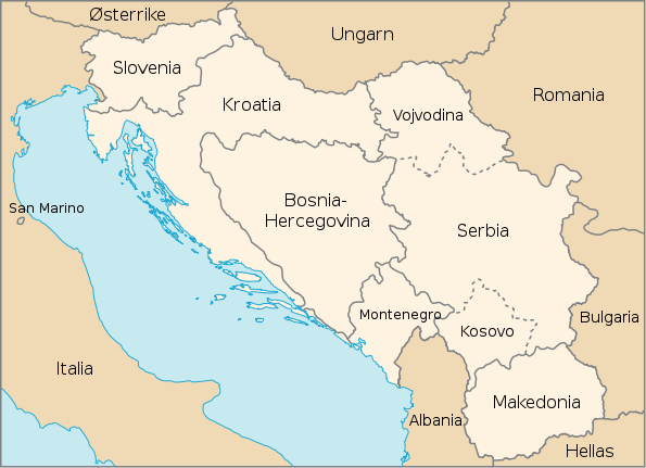
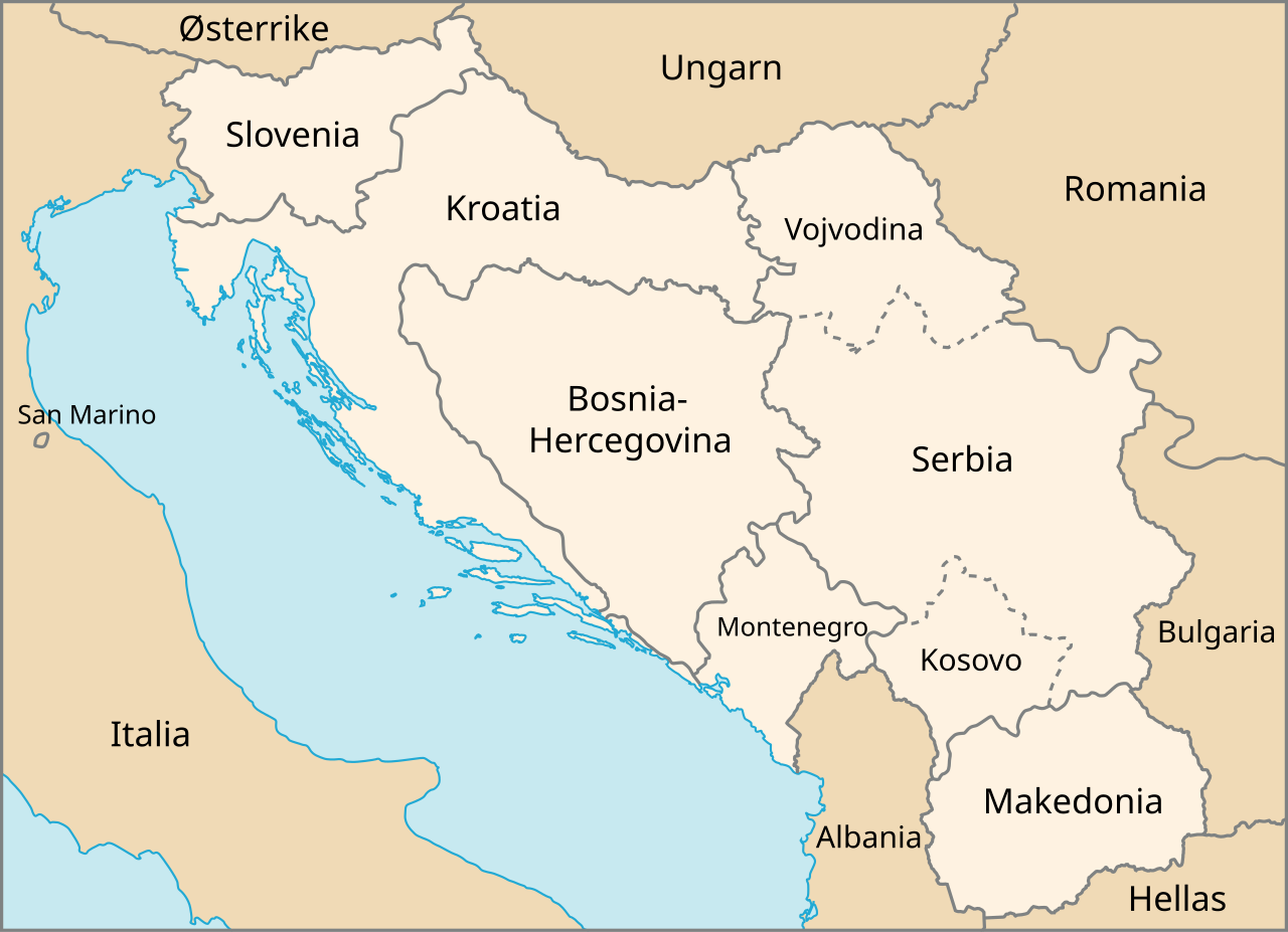
| Açıklama | Map of The Former Yugoslavia in Norwegian | |||
| Tarih | February, 2003 (created), February, 2007 (edited) | |||
| Kaynak | http://www.un.org/Depts/Cartographic/map/profile/frmryugo.pdf | |||
| Yazar | Department of Public Information Cartographic Section, edited by Stian H. | |||
| İzin (Bu dosyanın tekrar kullanımı) |
|

Dosya geçmişi
Dosyanın herhangi bir zamandaki hâli için ilgili tarih/saat kısmına tıklayın.
| Tarih/Saat | Küçük resim | Boyutlar | Kullanıcı | Yorum | |
|---|---|---|---|---|---|
| güncel | 17.29, 19 Şubat 2007 | | 595 × 431 (315 KB) | Stianbh | {{Information| |Description=Map of The Former Yugoslavia in Norwegian |Source=http://www.un.org/Depts/Cartographic/map/profile/frmryugo.pdf |Date=February, 2003 (created), February, 2007 (edited) |Author=Department of Public Information Cartographic Secti |
Dosya kullanımı
Bu görüntü dosyasına bağlanan sayfa yok.
Küresel dosya kullanımı
Aşağıdaki diğer vikiler bu dosyayı kullanır:
- fi.wikipedia.org üzerinde kullanımı
- nn.wikipedia.org üzerinde kullanımı
- no.wikipedia.org üzerinde kullanımı