Dosya:Langeness.png

Bu önizlemenin boyutu: 800 × 493 piksel. Diğer çözünürlükler: 320 × 197 piksel | 640 × 395 piksel | 981 × 605 piksel.
Tam çözünürlük ((981 × 605 piksel, dosya boyutu: 1,04 MB, MIME tipi: image/png))
Bu dosya Wikimedia Commons'ta bulunmaktadır. Dosyanın açıklaması aşağıda gösterilmiştir. Commons, serbest/özgür telifli medya dosyalarının bulundurulduğu depodur. Siz de yardım edebilirsiniz. |
Özet
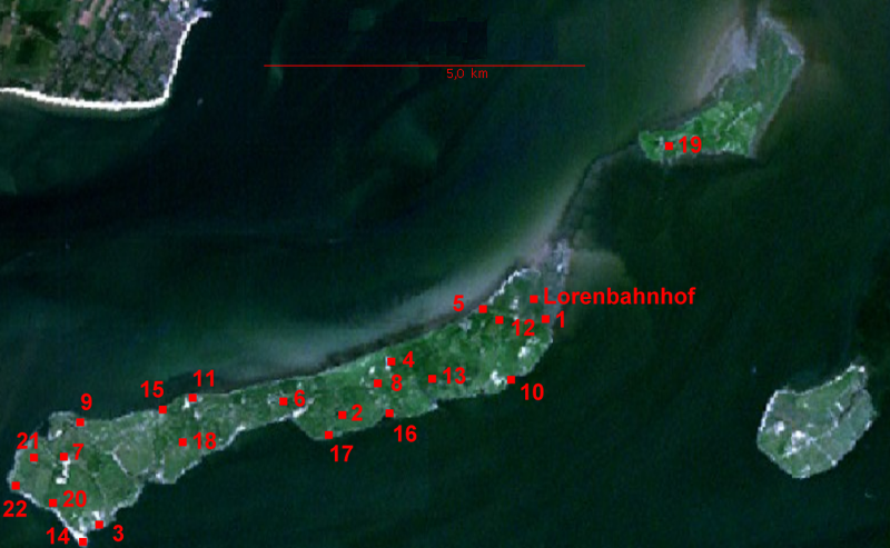
NASA World Wind screen image of Halligen Langeness and Oland, Germany. Numbers of settlements (terps) added by uploader
Lisanslama
| This image is in the public domain because it is a screenshot from NASA’s globe software World Wind using a public domain layer, such as Blue Marble, MODIS, Landsat, SRTM, USGS or GLOBE.
|
 |
| Annotations | This image is annotated: View the annotations at Commons |
Dosya geçmişi
Dosyanın herhangi bir zamandaki hâli için ilgili tarih/saat kısmına tıklayın.
| Tarih/Saat | Küçük resim | Boyutlar | Kullanıcı | Yorum | |
|---|---|---|---|---|---|
| güncel | 20.44, 4 Aralık 2006 | | 981 × 605 (1,04 MB) | Ratzer | corrected version uploaded under same name |
| 20.32, 4 Aralık 2006 |  | 981 × 605 (1,04 MB) | Ratzer | NASA World Wind screen image numbers of settlements (terps) added by uploader |
Dosya kullanımı
Bu görüntü dosyasına bağlantısı olan sayfalar:
Küresel dosya kullanımı
Aşağıdaki diğer vikiler bu dosyayı kullanır:
- de.wikipedia.org üzerinde kullanımı
- eo.wikipedia.org üzerinde kullanımı
- fy.wikipedia.org üzerinde kullanımı
- ru.wikipedia.org üzerinde kullanımı