Dosya:Lage des Landkreises Torgau-Oschatz in Deutschland.png
Daha yüksek çözünürlüğe sahip sürüm bulunmamaktadır.
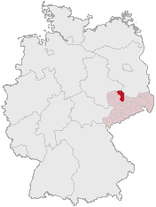
Lage_des_Landkreises_Torgau-Oschatz_in_Deutschland.png ((176 × 234 piksel, dosya boyutu: 4 KB, MIME tipi: image/png))
Bu dosya Wikimedia Commons'ta bulunmaktadır. Dosyanın açıklaması aşağıda gösterilmiştir. Commons, serbest/özgür telifli medya dosyalarının bulundurulduğu depodur. Siz de yardım edebilirsiniz. |
Özet
Karte erstellt auf der Grundlage der opengeodb.de-Umrisse.
Moved from de.wikipedia.org, first uploaded by de:Benutzer:Geograv.
Lisanslama
This image was generated with OpenGeoDB. The information there is placed in the public domain, images generated from OpenGeoDB are derivative works without passing the threshold of creativity, they are therefore also public domain.
| Bu çalışma telif hakkı için uygun değildir ve bu nedenle kamu malı kapsamındadır çünkü tamamen ortak mülkiyet ve orijinal yazarlık içermez. |
Dosya geçmişi
Dosyanın herhangi bir zamandaki hâli için ilgili tarih/saat kısmına tıklayın.
| Tarih/Saat | Küçük resim | Boyutlar | Kullanıcı | Yorum | |
|---|---|---|---|---|---|
| güncel | 21.30, 31 Mayıs 2006 | | 176 × 234 (4 KB) | Rauenstein | == Summary == Karte erstellt auf der Grundlage der opengeodb.de-Umrisse. Moved from de.wikipedia.org, first uploaded by de:Benutzer:Geograv. == License == {{GFDL-OpenGeoDB}} Category:Maps of Saxony |
Dosya kullanımı
Bu görüntü dosyasına bağlantısı olan sayfalar:
Küresel dosya kullanımı
Aşağıdaki diğer vikiler bu dosyayı kullanır:
- de.wikipedia.org üzerinde kullanımı
- es.wikipedia.org üzerinde kullanımı
- fr.wikipedia.org üzerinde kullanımı
- it.wikipedia.org üzerinde kullanımı
- ka.wikipedia.org üzerinde kullanımı
- kk.wikipedia.org üzerinde kullanımı
- nl.wikipedia.org üzerinde kullanımı
- pl.wikipedia.org üzerinde kullanımı
- pt.wikipedia.org üzerinde kullanımı
- uk.wikipedia.org üzerinde kullanımı