Dosya:Droysen - Oströmisches Reich.jpg
Tam çözünürlük ((3.025 × 2.000 piksel, dosya boyutu: 1,09 MB, MIME tipi: image/jpeg))
Bu dosya Wikimedia Commons'ta bulunmaktadır. Dosyanın açıklaması aşağıda gösterilmiştir. Commons, serbest/özgür telifli medya dosyalarının bulundurulduğu depodur. Siz de yardım edebilirsiniz. |
Özet
| Açıklama |
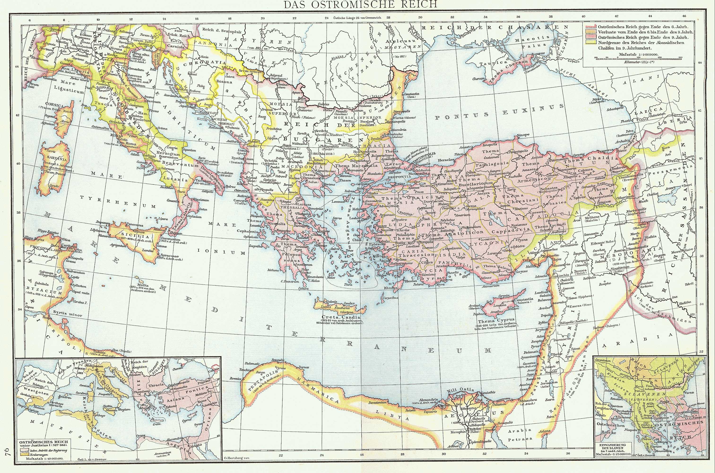
English: Map of the Byzantine Empire taken from G. Droysens Allgemeiner Historischer Handatlas, Verlag Velhagen und Klasing 1886
Deutsch: Karte des Byzantinischen (Oströmischen) Reiches aus G. Droysens Allgemeiner Historischer Handatlas, Verlag Velhagen und Klasing 1886 |
| Tarih | |
| Kaynak | G. Droysens Allgemeiner Historischer Handatlas, Verlag Velhagen und Klasing, Bielefeld / Leipzig 1886 |
| Yazar | Professor Gustav Droysen (Hg.), Professor G. Hertzberg (Zeichnung) |
Lisanslama
|
Bu çalışma ABD'de veya yazarın yaşamının sona ermiş olmasından 70 veya daha fazla süre geçtiğinde bu duruma uygun telif yasaları olan tüm ülkelerde kamu malıdır.
| |
| Bu dosya ve ilgili diğer hakları da dahil olmak üzere telif hakkı kapsamında bilinen tüm kısıtlamalar, serbest lisans olarak belirlenmiştir. | |
Dosya geçmişi
Dosyanın herhangi bir zamandaki hâli için ilgili tarih/saat kısmına tıklayın.
| Tarih/Saat | Küçük resim | Boyutlar | Kullanıcı | Yorum | |
|---|---|---|---|---|---|
| güncel | 16.16, 16 Kasım 2022 | | 3.025 × 2.000 (1,09 MB) | Gyalu22 | Reverted to version as of 10:14, 10 July 2009 (UTC) |
| 14.46, 20 Eylül 2016 |  | 3.025 × 2.000 (2,31 MB) | Julieta39 | Better contrast | |
| 10.14, 10 Temmuz 2009 |  | 3.025 × 2.000 (1,09 MB) | Nikephoros | {{Information |Description={{en|1=Map of the Byzantine Empire taken from ''G. Droysens Allgemeiner Historischer Handatlas'', Verlag Velhagen und Klasing 1886}} {{de|1=Karte des Byzantinischen (Oströmischen) Reiches aus ''G. Droysens Allgemeiner Historisc |
Dosya kullanımı
Bu görüntü dosyasına bağlantısı olan sayfalar:
Küresel dosya kullanımı
Aşağıdaki diğer vikiler bu dosyayı kullanır:
- als.wikipedia.org üzerinde kullanımı
- ar.wikipedia.org üzerinde kullanımı
- de.wikipedia.org üzerinde kullanımı
- en.wikipedia.org üzerinde kullanımı
- es.wikipedia.org üzerinde kullanımı
- fr.wikipedia.org üzerinde kullanımı
- he.wikipedia.org üzerinde kullanımı
- id.wikipedia.org üzerinde kullanımı
- it.wikipedia.org üzerinde kullanımı
- la.wikipedia.org üzerinde kullanımı
- mk.wikipedia.org üzerinde kullanımı
- nl.wikipedia.org üzerinde kullanımı
- pt.wikipedia.org üzerinde kullanımı
- ro.wikipedia.org üzerinde kullanımı
- ru.wikipedia.org üzerinde kullanımı
- uk.wikipedia.org üzerinde kullanımı
- zh.wikipedia.org üzerinde kullanımı