Dosya:Dresden Map 1895.jpg

Bu önizlemenin boyutu: 469 × 600 piksel. Diğer çözünürlükler: 188 × 240 piksel | 375 × 480 piksel | 600 × 768 piksel | 800 × 1.024 piksel | 1.601 × 2.048 piksel | 2.938 × 3.758 piksel.
Tam çözünürlük ((2.938 × 3.758 piksel, dosya boyutu: 2,77 MB, MIME tipi: image/jpeg))
Bu dosya Wikimedia Commons'ta bulunmaktadır. Dosyanın açıklaması aşağıda gösterilmiştir. Commons, serbest/özgür telifli medya dosyalarının bulundurulduğu depodur. Siz de yardım edebilirsiniz. |
| Açıklama |
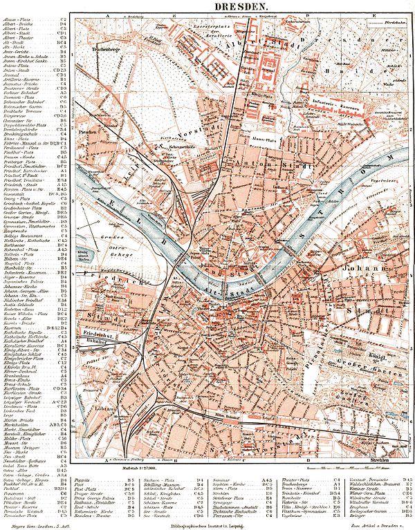
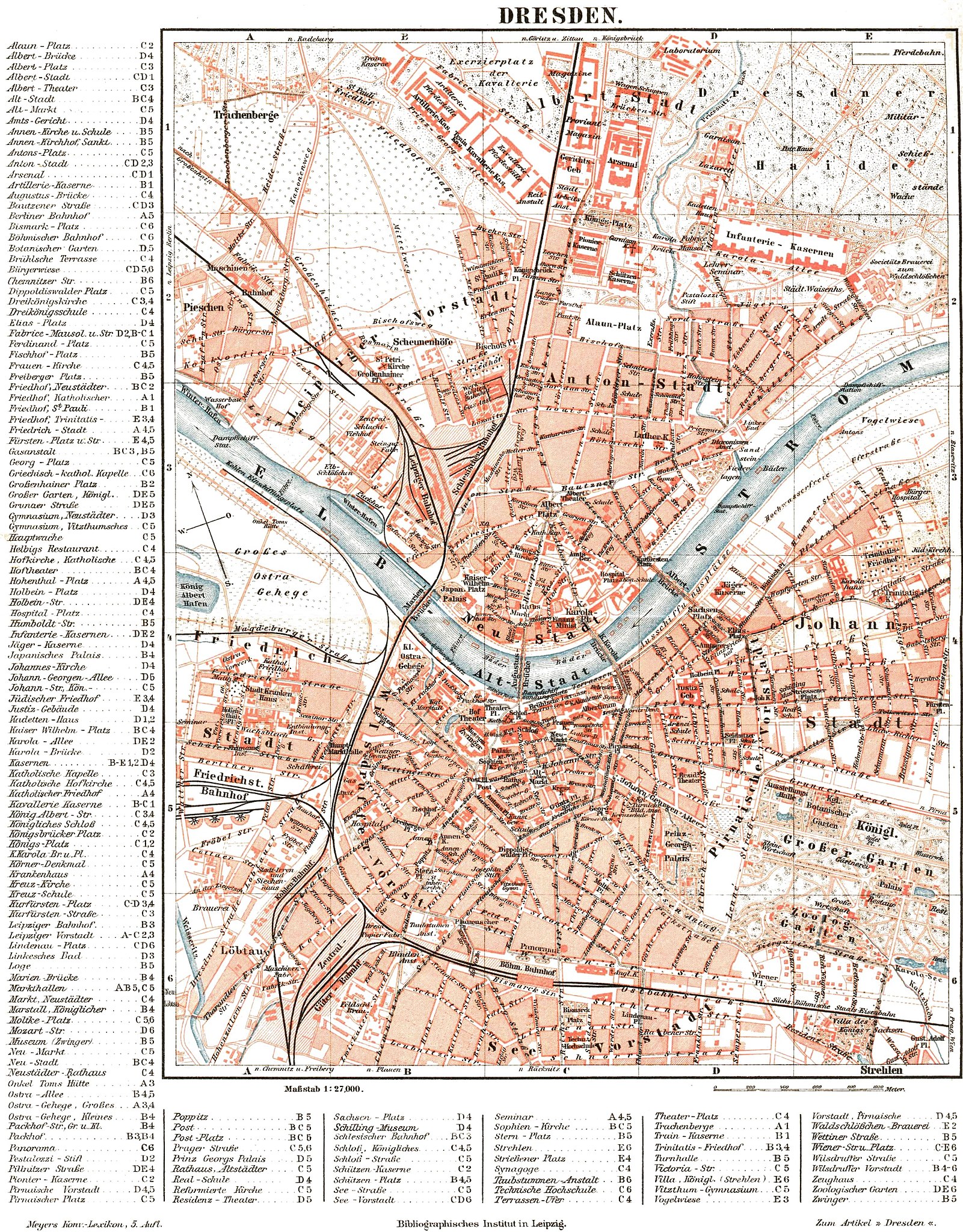
English: Map of Dresden, about 1895. |
| Tarih |
Deutsch: um 1895 |
| Kaynak | Meyers Konversationslexikon (5. Aufl., 1893-97) |
| Yazar | Bilinmiyor |
| Diğer sürümler |

| This image comes from the 5th edition of Meyers Konversationslexikon (1893-97). The copyrights have expired and this image is in the public domain. | 
|
This work was published before January 1, 1899 and it is anonymous or pseudonymous due to unknown authorship. It is in the public domain in the United States as well as countries and areas where the copyright terms of anonymous or pseudonymous works are 125 years or fewer since publication.
|
| Open this image as an overlay in Google Earth (Google Maps, Bing) | (Help|Source) |
Dosya geçmişi
Dosyanın herhangi bir zamandaki hâli için ilgili tarih/saat kısmına tıklayın.
| Tarih/Saat | Küçük resim | Boyutlar | Kullanıcı | Yorum | |
|---|---|---|---|---|---|
| güncel | 19.17, 5 Eylül 2005 | | 2.938 × 3.758 (2,77 MB) | Alexander Fischer | commercial inscription (www.hicleones.com) removed |
| 18.51, 5 Eylül 2005 |  | 2.938 × 3.758 (2,77 MB) | Alexander Fischer | Map of Dresden, about 1895 {{PD-Meyers-5th-edition}} |
Dosya kullanımı
Bu görüntü dosyasına bağlanan sayfa yok.
Küresel dosya kullanımı
Aşağıdaki diğer vikiler bu dosyayı kullanır:
- de.wikipedia.org üzerinde kullanımı
- de.wikiversity.org üzerinde kullanımı
- es.wikipedia.org üzerinde kullanımı
- fr.wikipedia.org üzerinde kullanımı