Dosya:SomersetSouth.png
Daha yüksek çözünürlüğe sahip sürüm bulunmamaktadır.
SomersetSouth.png ((200 × 101 piksel, dosya boyutu: 6 KB, MIME tipi: image/png))
Bu dosya Wikimedia Commons'ta bulunmaktadır. Dosyanın açıklaması aşağıda gösterilmiştir. Commons, serbest/özgür telifli medya dosyalarının bulundurulduğu depodur. Siz de yardım edebilirsiniz. |
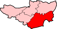
South Somerset district in Somerset
Created by en:User:Morwen

|
Bu belgenin GNU Özgür Belgeleme Lisansı, Sürüm 1.2 veya Özgür Yazılım Vakfı tarafından yayımlanan sonraki herhangi bir sürüm şartları altında bu belgenin kopyalanması, dağıtılması ve/veya değiştirilmesi için izin verilmiştir;
Değişmeyen Bölümler, Ön Kapak Metinleri ve Arka Kapak Metinleri yoktur. Lisansın bir kopyası GNU Özgür Belgeleme Lisansı sayfasında yer almaktadır. |
| Bu dosya, Creative Commons Atıf-Benzer Paylaşım 3.0 Taşınmamış lisansı ile lisanslanmıştır | ||
| ||
| Bu lisanslama etiketi, dosyaya GFDL lisanslama güncelleştirmenin bir parçası olarak eklenmiştir. |
Dosya geçmişi
Dosyanın herhangi bir zamandaki hâli için ilgili tarih/saat kısmına tıklayın.
| Tarih/Saat | Küçük resim | Boyutlar | Kullanıcı | Yorum | |
|---|---|---|---|---|---|
| güncel | 13.58, 8 Şubat 2010 | | 200 × 101 (6 KB) | Mahahahaneapneap | Transparent background |
| 15.11, 24 Mayıs 2006 |  | 200 × 101 (10 KB) | Nichtbesserwisser | South Somerset district in Somerset Created by en:User:Morwen {{GFDL}} Category:Maps of districts in South West England |
Dosya kullanımı
Bu görüntü dosyasına bağlantısı olan sayfalar:
Küresel dosya kullanımı
Aşağıdaki diğer vikiler bu dosyayı kullanır:
- bg.wikipedia.org üzerinde kullanımı
- de.wikipedia.org üzerinde kullanımı
- en.wikipedia.org üzerinde kullanımı
- Yeovil
- Ilminster
- Ilchester
- South Somerset
- Somerton, Somerset
- Chard, Somerset
- South Cadbury
- East Coker
- Castle Cary
- Crewkerne
- Yeovilton
- Merriott
- Montacute
- Martock
- Ashill, Somerset
- Wincanton
- Abbas Combe
- Templecombe
- Aller, Somerset
- Barton St David
- Langport
- Chiselborough
- Dowlish Wake
- Alford, Somerset
- Ansford
- Ash, South Somerset
- Babcary
- Barrington, Somerset
- Barwick, Somerset
- Beercrocombe
- Bratton Seymour
- Brewham
- Broadway, Somerset
- Bruton
- Brympton
- Buckland St Mary
- Chaffcombe
- Charlton Horethorne
- Charlton Mackrell
- Charlton Musgrove
- Chillington, Somerset
- Chilthorne Domer
- Chilton Cantelo
- Closworth
- Combe St Nicholas
- Compton Dundon
- Compton Pauncefoot
Bu dosyanın daha fazla küresel kullanımını görüntüle.