Dosya:Europe mediterranean 1097.jpg

Tam çözünürlük ((2.270 × 1.789 piksel, dosya boyutu: 4,85 MB, MIME tipi: image/jpeg))
Bu dosya Wikimedia Commons'ta bulunmaktadır. Dosyanın açıklaması aşağıda gösterilmiştir. Commons, serbest/özgür telifli medya dosyalarının bulundurulduğu depodur. Siz de yardım edebilirsiniz. |


|
This map has been uploaded by Electionworld from en.wikipedia.org to enable the |
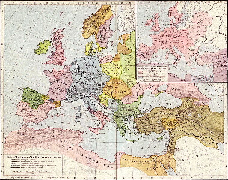
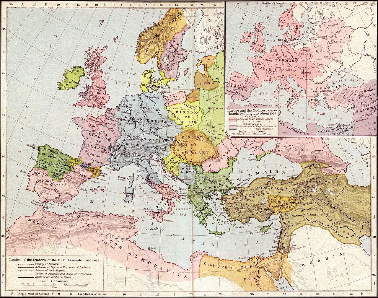
Map of Mediterranean and European lands anout 1097. Map from: Historical Atlas by William Shepherd (1923-26), in Public Domain
|
Bu çalışma ABD'de veya yazarın yaşamının sona ermiş olmasından 70 veya daha fazla süre geçtiğinde bu duruma uygun telif yasaları olan tüm ülkelerde kamu malıdır.
| |
| Bu dosya ve ilgili diğer hakları da dahil olmak üzere telif hakkı kapsamında bilinen tüm kısıtlamalar, serbest lisans olarak belirlenmiştir. | |
.jpg)
Dosya geçmişi
Dosyanın herhangi bir zamandaki hâli için ilgili tarih/saat kısmına tıklayın.
| Tarih/Saat | Küçük resim | Boyutlar | Kullanıcı | Yorum | |
|---|---|---|---|---|---|
| güncel | 03.36, 27 Eylül 2021 | | 2.270 × 1.789 (4,85 MB) | GPinkerton | Reverted to version as of 01:31, 30 January 2007 (UTC) do not alter historical maps! |
| 18.03, 26 Haziran 2020 |  | 2.270 × 1.789 (4,84 MB) | Claude Zygiel | Map of Europe and Mediterranean lands about 1097: Byzantine Empire had not been completely excluded from Anatolia (Mantzikert, 1071) and the lower Danube was not pagan even if Pechenegs were Tengrists. | |
| 01.31, 30 Ocak 2007 |  | 2.270 × 1.789 (4,85 MB) | Patrickneil | {{ew|en|Wirya}} Map of Kurdistan and Mediterranean and European lands anout 1097. Map from: [http://www.lib.utexas.edu/maps/historical/shepherd/europe_mediterranean_1097.jpg], in Public Domain {{PD-old}} | |
| 14.59, 3 Aralık 2006 |  | 2.314 × 1.805 (725 KB) | Electionworld | {{ew|en|Wirya}} Map of Kurdistan and Mediterranean and European lands anout 1097. Map from: [http://www.lib.utexas.edu/maps/historical/shepherd/europe_mediterranean_1097.jpg], in Public Domain {{PD}} |
Dosya kullanımı
Bu görüntü dosyasına bağlantısı olan sayfalar:
Küresel dosya kullanımı
Aşağıdaki diğer vikiler bu dosyayı kullanır:
- ast.wikipedia.org üzerinde kullanımı
- ba.wikipedia.org üzerinde kullanımı
- bg.wikipedia.org üzerinde kullanımı
- ce.wikipedia.org üzerinde kullanımı
- ckb.wikipedia.org üzerinde kullanımı
- de.wikipedia.org üzerinde kullanımı
- el.wikipedia.org üzerinde kullanımı
- en.wikipedia.org üzerinde kullanımı
- es.wikipedia.org üzerinde kullanımı
- et.wikipedia.org üzerinde kullanımı
- fa.wikipedia.org üzerinde kullanımı
- fr.wikipedia.org üzerinde kullanımı
- gl.wikipedia.org üzerinde kullanımı
- hu.wikipedia.org üzerinde kullanımı
- id.wikipedia.org üzerinde kullanımı
- it.wikipedia.org üzerinde kullanımı
- ms.wikipedia.org üzerinde kullanımı
- nn.wikipedia.org üzerinde kullanımı
- pnb.wikipedia.org üzerinde kullanımı
- pt.wikipedia.org üzerinde kullanımı
- ro.wikipedia.org üzerinde kullanımı
- ru.wikipedia.org üzerinde kullanımı
Bu dosyanın daha fazla küresel kullanımını görüntüle.