Dosya:Europe location ENG2.png

Bu önizlemenin boyutu: 800 × 599 piksel. Diğer çözünürlükler: 320 × 240 piksel | 640 × 479 piksel | 1.024 × 767 piksel | 1.280 × 959 piksel | 1.594 × 1.194 piksel.
Tam çözünürlük ((1.594 × 1.194 piksel, dosya boyutu: 728 KB, MIME tipi: image/png))
Bu dosya Wikimedia Commons'ta bulunmaktadır. Dosyanın açıklaması aşağıda gösterilmiştir. Commons, serbest/özgür telifli medya dosyalarının bulundurulduğu depodur. Siz de yardım edebilirsiniz. |
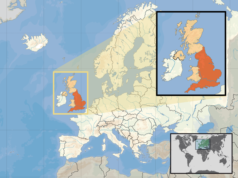
| Açıklama | Location of England in the UK and Europe, on terrain map showing surface and underwater contour areas. | |||
| Tarih | ||||
| Kaynak | Derived from Wikimedia Commons image of original work forming part of the "Europe location" map series created by David Liuzzo: derived from Image:Europe_location_ENG.png. | |||
| Yazar | uploaded by User:Kmusser (excerpt from User:David_Liuzzo) | |||
| İzin (Bu dosyanın tekrar kullanımı) |
|
|||
| Diğer sürümler |
|


Dosya geçmişi
Dosyanın herhangi bir zamandaki hâli için ilgili tarih/saat kısmına tıklayın.
| Tarih/Saat | Küçük resim | Boyutlar | Kullanıcı | Yorum | |
|---|---|---|---|---|---|
| güncel | 14.58, 14 Şubat 2011 | | 1.594 × 1.194 (728 KB) | Beao | Removed border. |
| 19.00, 29 Eylül 2008 |  | 1.600 × 1.200 (792 KB) | Kmusser | {{Information |Description= Location of England in the UK and Europe, on terrain map showing surface and underwater contour areas. |Source=Derived from Wikimedia Commons image of original work forming part of the "Europe location" map series c |
Dosya kullanımı
Bu görüntü dosyasına bağlanan sayfa yok.
Küresel dosya kullanımı
Aşağıdaki diğer vikiler bu dosyayı kullanır:
- ace.wikipedia.org üzerinde kullanımı
- ar.wikipedia.org üzerinde kullanımı
- az.wiktionary.org üzerinde kullanımı
- bn.wikipedia.org üzerinde kullanımı
- br.wikipedia.org üzerinde kullanımı
- cs.wikipedia.org üzerinde kullanımı
- da.wikipedia.org üzerinde kullanımı
- dsb.wikipedia.org üzerinde kullanımı
- dty.wikipedia.org üzerinde kullanımı
- en.wikipedia.org üzerinde kullanımı
- es.wikipedia.org üzerinde kullanımı
- eu.wiktionary.org üzerinde kullanımı
- ext.wikipedia.org üzerinde kullanımı
- fiu-vro.wikipedia.org üzerinde kullanımı
- hr.wikiquote.org üzerinde kullanımı
- incubator.wikimedia.org üzerinde kullanımı
- ja.wiktionary.org üzerinde kullanımı
- ka.wikipedia.org üzerinde kullanımı
- my.wikipedia.org üzerinde kullanımı
- nds-nl.wikipedia.org üzerinde kullanımı
- nl.wikibooks.org üzerinde kullanımı
- pam.wikipedia.org üzerinde kullanımı
- pl.wikipedia.org üzerinde kullanımı
- pl.wiktionary.org üzerinde kullanımı
- pnb.wikipedia.org üzerinde kullanımı
- pt.wiktionary.org üzerinde kullanımı
- sc.wikipedia.org üzerinde kullanımı
- shn.wikipedia.org üzerinde kullanımı
- simple.wikipedia.org üzerinde kullanımı
- sr.wikipedia.org üzerinde kullanımı
- sv.wikivoyage.org üzerinde kullanımı
- vls.wikipedia.org üzerinde kullanımı
- xmf.wikipedia.org üzerinde kullanımı
- yo.wikipedia.org üzerinde kullanımı
- zh.wikinews.org üzerinde kullanımı