Dosya:Central and Eastern Europe Map.png

Tam çözünürlük ((2.416 × 3.230 piksel, dosya boyutu: 1,37 MB, MIME tipi: image/png))
Bu dosya Wikimedia Commons'ta bulunmaktadır. Dosyanın açıklaması aşağıda gösterilmiştir. Commons, serbest/özgür telifli medya dosyalarının bulundurulduğu depodur. Siz de yardım edebilirsiniz. |
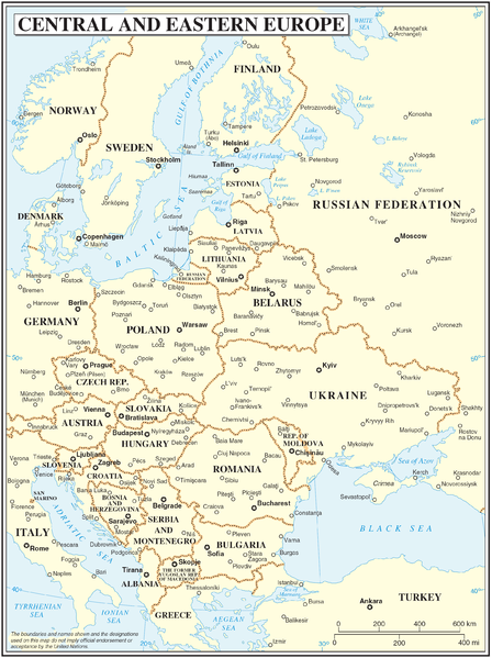
Central and Eastern Europe map
| Açıklama | Map of Central and Eastern Europe | |||
| Tarih | ||||
| Kaynak | The Cartographic Section of the United Nations (CSUN) | |||
| Yazar | Cartographer of the United Nations | |||
| İzin (Bu dosyanın tekrar kullanımı) |
|

Dosya geçmişi
Dosyanın herhangi bir zamandaki hâli için ilgili tarih/saat kısmına tıklayın.
| Tarih/Saat | Küçük resim | Boyutlar | Kullanıcı | Yorum | |
|---|---|---|---|---|---|
| güncel | 16.59, 10 Mart 2007 | | 2.416 × 3.230 (1,37 MB) | Minestrone | Central and Eastern Europe map {{Information |Description=Map of Central and Eastern Europe |Source=The Cartographic Section of the United Nations (CSUN) |Date=2007-03-10 |Author=Cartographer of the United Nations |Permission={{Template:UN map}} and |
Dosya kullanımı
Bu görüntü dosyasına bağlanan sayfa yok.
Küresel dosya kullanımı
Aşağıdaki diğer vikiler bu dosyayı kullanır:
- cs.wikipedia.org üzerinde kullanımı
- de.wikipedia.org üzerinde kullanımı
- en.wikipedia.org üzerinde kullanımı
- hr.wikipedia.org üzerinde kullanımı
- hu.wikipedia.org üzerinde kullanımı
- it.wikipedia.org üzerinde kullanımı
- lv.wikipedia.org üzerinde kullanımı
- pl.wikipedia.org üzerinde kullanımı
- th.wikipedia.org üzerinde kullanımı