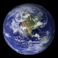
Dosya:BlueMarble-2001-2002.jpg

Bu önizlemenin boyutu: 800 × 400 piksel. Diğer çözünürlükler: 320 × 160 piksel | 640 × 320 piksel | 1.024 × 512 piksel | 1.280 × 640 piksel | 2.560 × 1.280 piksel | 4.096 × 2.048 piksel.
Tam çözünürlük ((4.096 × 2.048 piksel, dosya boyutu: 1,22 MB, MIME tipi: image/jpeg))
Dosya geçmişi
Dosyanın herhangi bir zamandaki hâli için ilgili tarih/saat kısmına tıklayın.
| Tarih/Saat | Küçük resim | Boyutlar | Kullanıcı | Yorum | |
|---|---|---|---|---|---|
| güncel | 22.14, 20 Aralık 2009 |  | 4.096 × 2.048 (1,22 MB) | Apoc2400 | High resolution. |
| 02.10, 3 Eylül 2005 |  | 405 × 203 (19 KB) | Saperaud~commonswiki | NASA created these two images to exhibit high-resolution global composites of Moderate Resolution Imaging Spectroradiometer [http://modarch.gsfc.nasa.gov (MODIS)] data. The land surface data were acquired from June through September of 2001. The clouds we |
Dosya kullanımı
Bu görüntü dosyasına bağlantısı olan sayfalar:
Küresel dosya kullanımı
Aşağıdaki diğer vikiler bu dosyayı kullanır:
- af.wikipedia.org üzerinde kullanımı
- ar.wikipedia.org üzerinde kullanımı
- ast.wikipedia.org üzerinde kullanımı
- az.wikipedia.org üzerinde kullanımı
- ba.wikipedia.org üzerinde kullanımı
- be.wikipedia.org üzerinde kullanımı
- bh.wikipedia.org üzerinde kullanımı
- bn.wikipedia.org üzerinde kullanımı
- bo.wikipedia.org üzerinde kullanımı
- bs.wikipedia.org üzerinde kullanımı
- ca.wikipedia.org üzerinde kullanımı
- cs.wikipedia.org üzerinde kullanımı
- cy.wikipedia.org üzerinde kullanımı
- da.wikipedia.org üzerinde kullanımı
- de.wikipedia.org üzerinde kullanımı
- diq.wikipedia.org üzerinde kullanımı
- el.wikipedia.org üzerinde kullanımı
- en.wikipedia.org üzerinde kullanımı
- Marine biology
- Environmental movement
- Environmental science
- Twin Earth thought experiment
- Underwater environment
- The Blue Marble
- Ecosystem diversity
- Habitable zone
- Environmental history
- Origin of water on Earth
- Portal:Environment
- Portal:Environment/Selected article
- Portal:Environment/Selected article/14
- Sea
- Talk:Sustainability/Archive 8
- User:Nick carson/sandbox
- Talk:Sustainability/Lead
- Talk:Sustainability/Archive 25
Bu dosyanın daha fazla küresel kullanımını görüntüle.


